Grenoble -around
the Railway.
6- The 'Estacade' flyover, the 'Cours Saint André', the 'Aigle' (Eagle) district.
-disused,
forgotten, taken away or
abandoned lines.
6- The 'Estacade' flyover, the 'Cours Saint André', the 'Aigle' (Eagle) district.
All
the pictures can be enlarged with a mouse click!


31- The 'Cours Saint André' around 1900.

32- The Saint André level crossing, nothing much happening!

33- There's plenty of time to cross the railway line.

34- Building the flyover on the 'Cours Saint André'.
The 'Cours Saint André' is now called the 'Cours Jean
Jaurès' and the 'Cours de la Libération' in Grenoble. It's name reverts
to 'Cours Saint André' in 'Pont de Claix'. This was the first major
avenue of Grenoble, created as a barrier against the wanderings of the
Drac. It has became the backbone of the city which is resolutely turned
towards the south, this is the road to Nice, the holiday road. But for
the railway it was an obstacle that was no longer tolerable in Olympic
times. There were many passengers to carry to the opening ceromony of
the games to the south of the city. The A480 motorway was made to bring
buses to the Olympic bus station, not far from 'Grand Place' today. For
trains, the flyover was constructed and the Chambery line moved
further south next to the southern ring road, the extremity of the new
motorway. The flyover removed three or four level crossings, amongst
them the Eagle(Aigle)
crossing. Napoleon, whose emblem was the eagle, stayed in an inn in the
district before being acclaimed by the population of Grenoble on March
7th, 1815.

35- In the middle of the 'Cours Jean Jaurès'.

36- The 'Avenue de Vizille' looking towards the 'Cours Berriat'.
37- Across the 'Cours Jean Jaurès' towards 'Joseph Rey'.

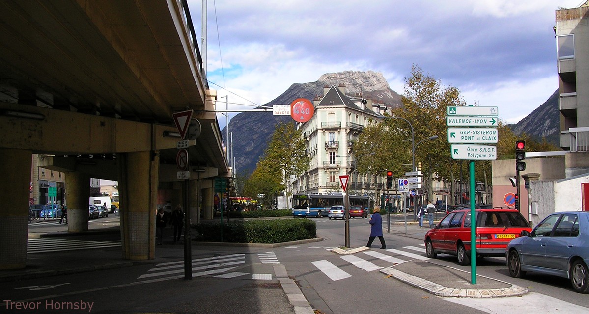
38- The 'Aigle' (Eagle) level crossing and tram stop 'A MONPLAISIR'.
The 'Aigle' (Eagle) level crossing is barely 200m
beyond the 'St. André' (St. Andrew) level crossing, but the 'rue
Turenne', which arrives here, is very important to travel towards the
city centre. On top of that, it was by here that the electric tramway
to 'Pont de Claix' passed, a tram that followed the length of the
'Cours St. André'.
The two old postcards of the level crossing may be separated by only twenty years, but the changes are already significant because of the architectural boom between 1900 and 1920. The stylish house in the middle is probably the only thing that remains today.
The two old postcards of the level crossing may be separated by only twenty years, but the changes are already significant because of the architectural boom between 1900 and 1920. The stylish house in the middle is probably the only thing that remains today.
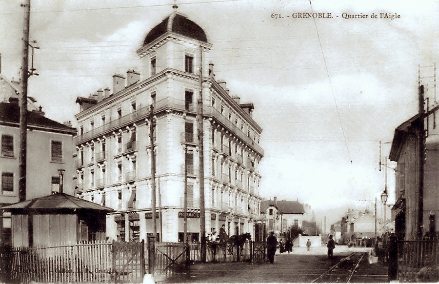
39- Even at this time, houses were replaced by blocks of flats.
40- 90 years later, the flyover has opened up the area.

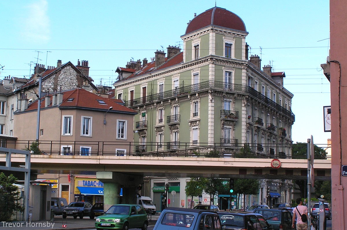
41- Turenne street, the mansion, moulded concrete and the 'Aigle' boarding school.
The two photos on the left show the 'Estacade' and the
'Rue Turenne' now. On the left, the green building, with it's exuberant
concrete mouldings from the 'Belle Epoque' and on the right the 'Aigle'
(eagle) boarding school. The fine mansion is still there in the centre.
She hasn't aged a bit!
As for the 'Monplaisir', it has gone, it would seem, to leave a little more room for the school.
As for the 'Monplaisir', it has gone, it would seem, to leave a little more room for the school.
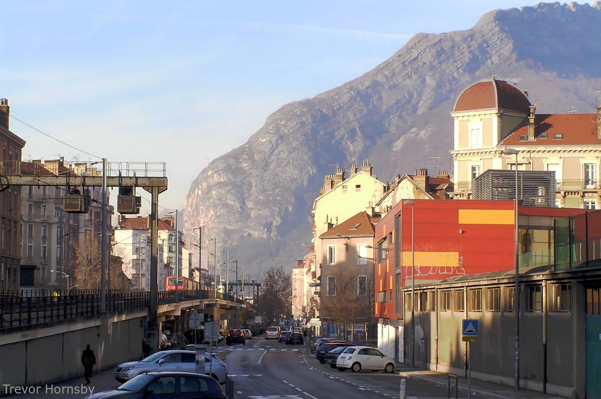
42- Looking back along the 'Estacade' to see how it arches.

43- We leave Desmoulins road by a cycle track.

44- Looking down on the 'Estacade' from the Foch bridge.
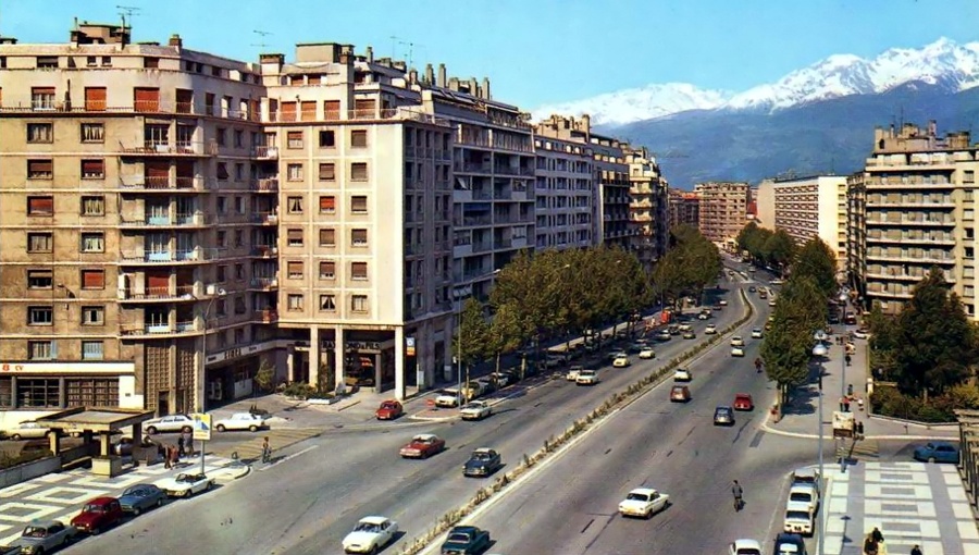
45- A postcard of Boulevard Foch from the 70's, in the front is the bridge.
Views from Foch bridge that crosses the two
railway lines, one of which is no longer used. That is the old line to
Chambery through the 'Capuche' district.
In the picture on the left, taken in the 1970s, we can see the Garage Raymond, now a low-cost supermarket.
On the right, the line 'C' for Seyssins rises slightly to cross the bridge, nibbling away a bit of the road, with its green carpet!
In the picture on the left, taken in the 1970s, we can see the Garage Raymond, now a low-cost supermarket.
On the right, the line 'C' for Seyssins rises slightly to cross the bridge, nibbling away a bit of the road, with its green carpet!

46- Tramway 'C' on boulevard Foch in the direction of the Vercors via Seyssins.

47- Mikado 141P15 at the 'Aigle' crossing around 1945. Nessé, 2009.
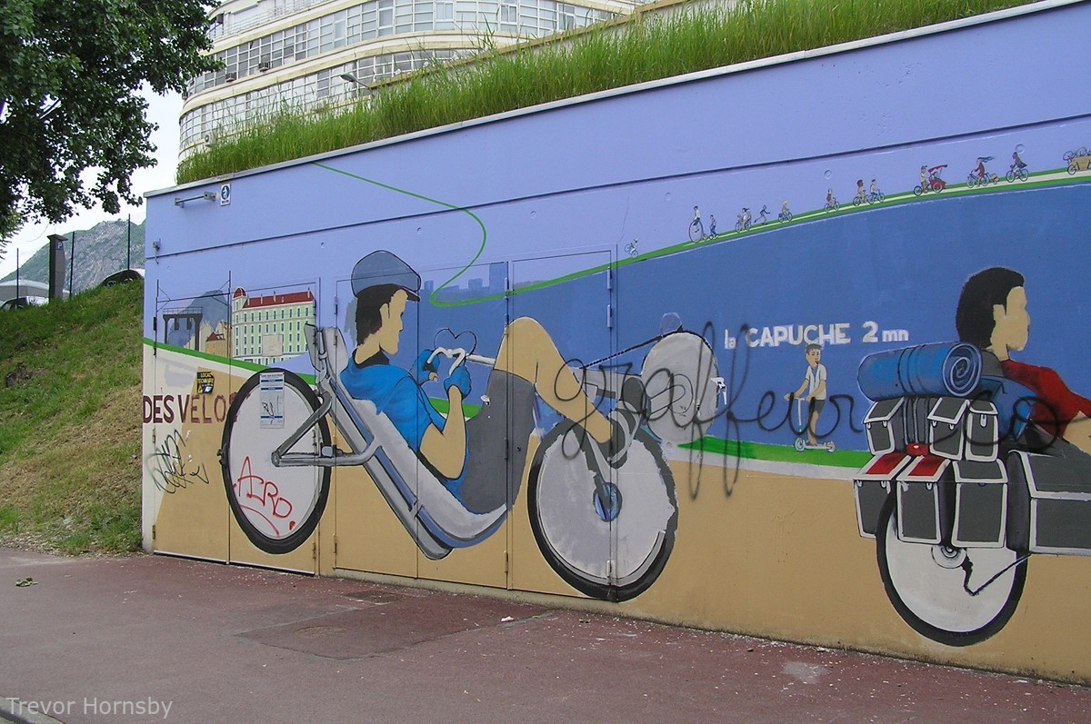
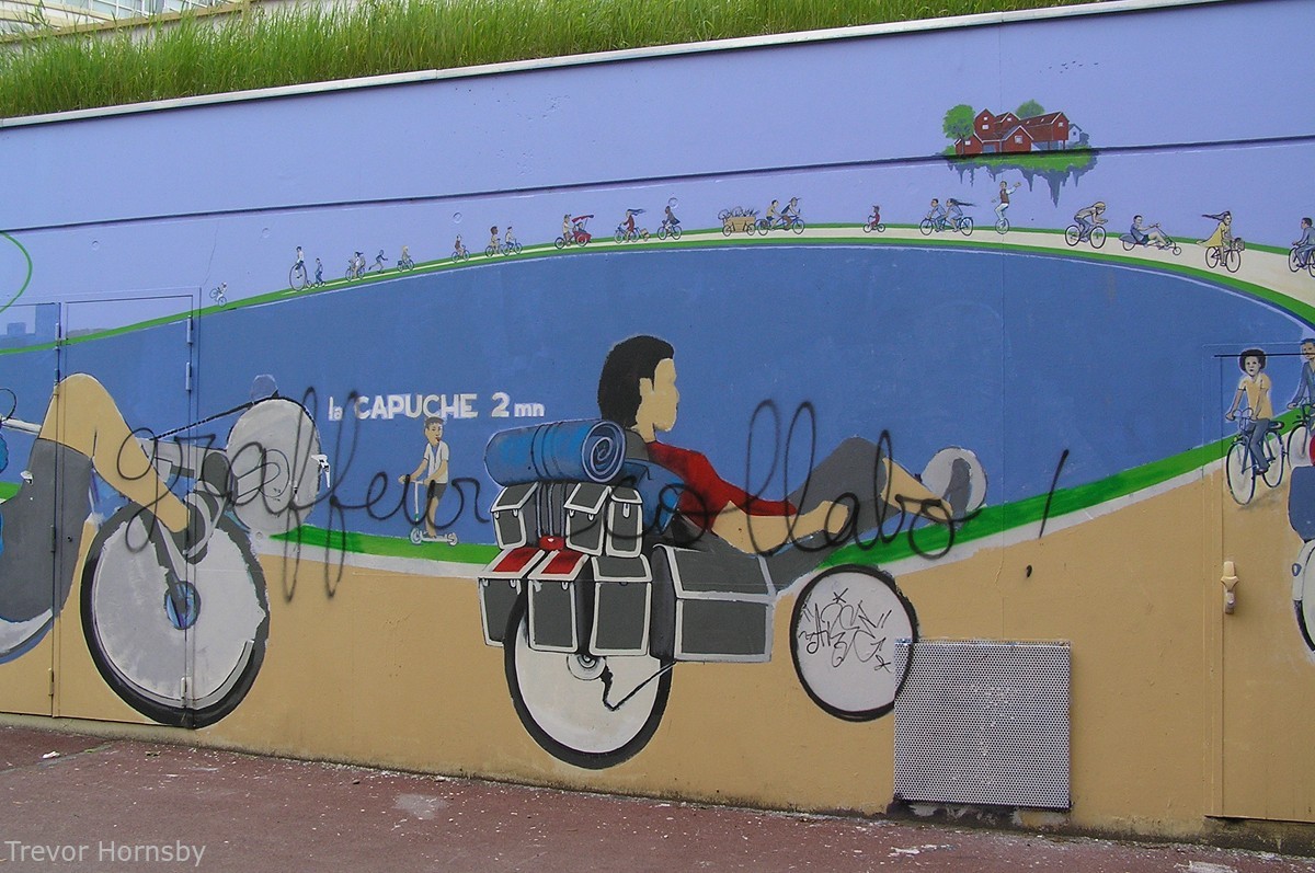
We are coming to the end of the 'Estacade'. Before
continuing along the railway tracks of today and the past, I have to
show you something very striking in the neighbourhood. It's wall art.
The 'Estacade' is covered with it from start to finish. But to see
more, visit this great web link HERE,
if you're interested of course.
But after crossing the Foch bridge, new discoveries await us, and new neighbourhoods.
But after crossing the Foch bridge, new discoveries await us, and new neighbourhoods.
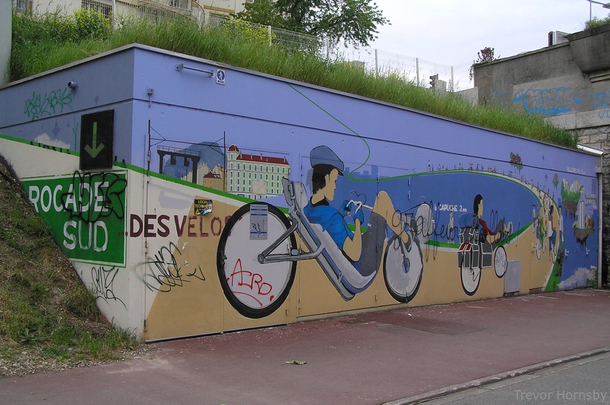
48- The bicycle Southern ring road. Wall art near the Foch bridge.
49- Detail 'Southern Ring-road for bicycles 1.
50- Detail 2.
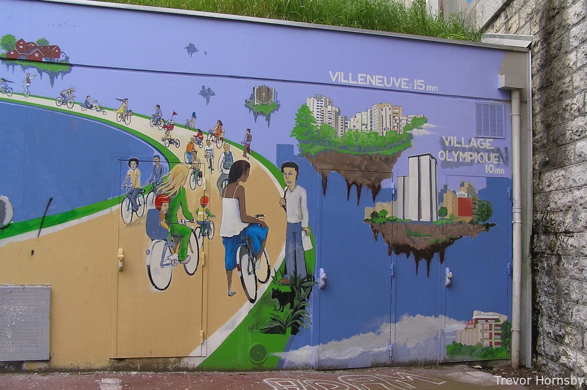
51- Detail 3.


Some Internet Links:
- http://www.hannibal-dans-les-alpes.com/
- http://1900anosjours.hpsam.info/photos/grenoble/exposition-internationale-1925.php
- http://insitu.revues.org/217#tocto1n2
- http://www.rocadesud.com/realisations/?actmenu=estacade&ID_rubrique=4
- http://www.artmajeur.com/?go=artworks/display_mini_gallery&image_id=2564745&login=nesse
- http://www.arcachon-nostalgie.com/roger_expert.htm
- http://insitu.revues.org/217#tocto1n2
- http://histoire.trains-en-vadrouille.com
- http://www.euro-photos-trains.com/sncf67300BBC.htm
- http://cccp.trainprovence.free.fr/cccp/article-alpazur2007.html
- http://clode.chez-alice.fr/fretgrenoble.htm
- http://www.lineoz.net/forum/viewtopic.php?f=3&t=3657&start=0
- http://membres.multimania.fr/stephanerevel/histo.htm
- http://www.ville-st-martin-dheres.fr/industrialistation.html
- http://emmatortue.wordpress.com/2009/05/15/ces-biscuits-ont-fait-les-delices-de-mon-enfance/
- La Vie du Rail, N°'s 1104, 1129, 1131 et 1137, Éditions NM Paris, 1967 et 1968.
- Le Bassin du Drac, Auguste Bouchayer. Revue de géographie alpine. Tome 13 N°3. pp. 549-621. 1925.
- Histoire Populaire de Grenoble, Alphonse Vernet. Gratier, 1896.
- Le Chemin de Fer de Grenoble à Villard de Lans. Philippe Guirimand et Patrice Bouillon, 2000.
- Grenoble Autrefois, Jean-Jacques de Corcelles. Horvath, 1996.
- Une Industrie dans la Ville, Bouchayer & Viallet à Grenoble. Hervé Bienfait. Libris, 2004.
- L'Illustration Economique et Financière, numéro spécial, Grenoble et l'Isère, 1923.
- Les Voies Ferrées du Dauphiné, Henri Boyer et Patrice Bouillon, 1983.
- Guide Catalogue Officiel de l'Exposition Internationale de la Houille Blanche et du Tourisme, Saumane 1925.
- Grenoble Autrefois, Claude Muller, Editions des Quatre Seigneurs, 1974.
- Du Tram au Tag, JM Guétat, W Lachenal, G Muller, La Vie du Rail,1987.
