Grenoble
-around the Railway.
13- The old Chambery line, from Marcelin Berthelot Avenue to Gières.
-disused,
forgotten, taken away or
abandoned lines.
13- The old Chambery line, from Marcelin Berthelot Avenue to Gières.
All
the pictures can be enlarged with a mouse click!


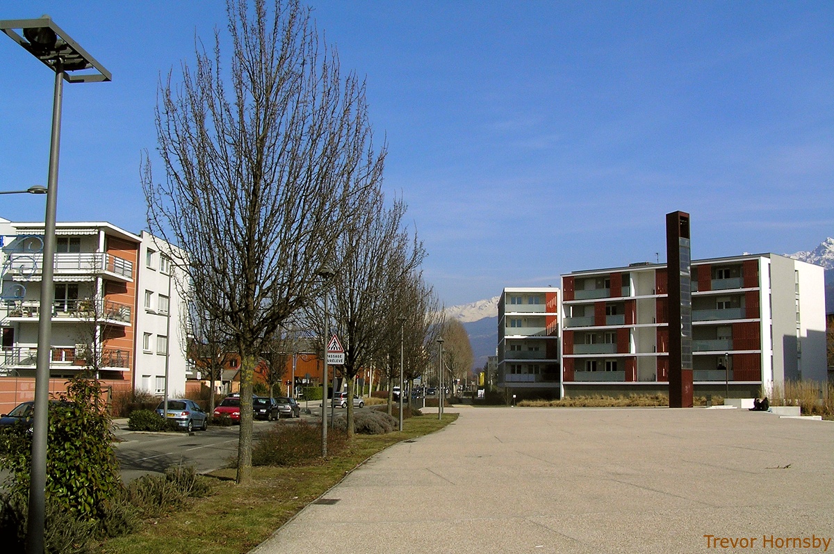
201- At the end of the old railway yard and sidings, MC2.

202- The buffers on the edge of Marcelin Berthelot avenue.l
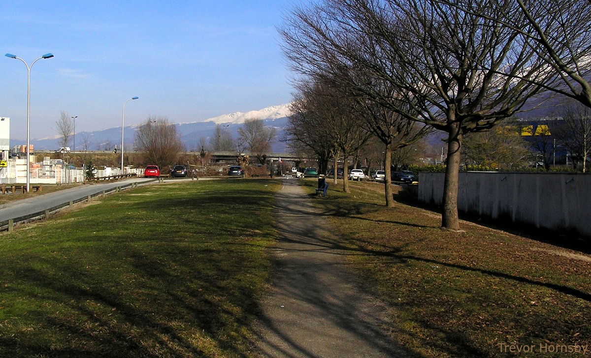
We're back in the area, between Stalingrad Road and
Marcelin Berthelot avenue, that was once used for sorting and storage
of railway equipment and freight. Now it is vacant land, partially a
green redeveloped space. It is intended, no doubt, to become part of
the Park Flaubert. We'll see!

203- Beside the avenue, the buffers mark 'The Beach'.
We are now in Marcelin Berthelot avenue, opposite the
Cultural centre, MC2. Here we are behind the buffer that is no longer
needed in recent years. Since the second track was removed in 1975,
traffic here is no longer possible. Street side, the buffer becomes an
indicator for 'The Beach', an amusement area set up next to 'The
Bifurck, in the summer.
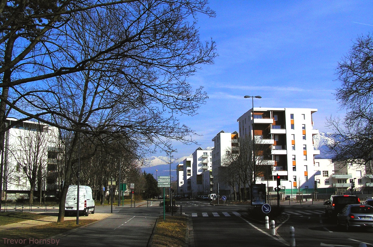
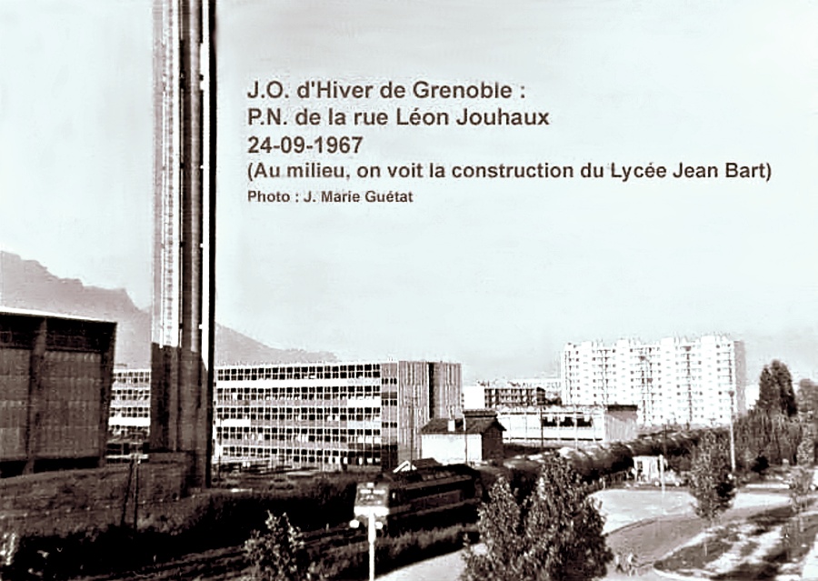
In the picture on the right, taken in 1967, the train for Chambery is ready to cross the level crossing at this location. Grenoble's Cultural Centre, is under construction to the right.
In the picture on the right, taken in 1967, the train for Chambery is ready to cross the level crossing at this location. Grenoble's Cultural Centre, is under construction to the right.

204- A train for Chambery the Marcelin Berthelot level crossing in 1967.

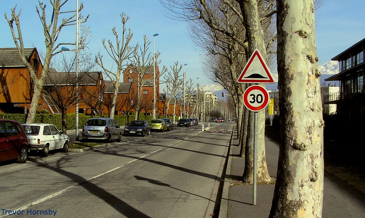
205- In front of the Cultural Centre, the line 'A' of the tramway.

206- A cycle track has taken the place of the old railway line.

207- Continuing along the cycle track, once the railway line.
208- The cycle track comes quickly to the Jean Perrot avenue.

209- This photo was taken during the construction of buildings used in the 1968 Olympics. The railway line is visible on the right.
We now arrive in Jean Perrot avenue. We have crossed
the area shown in the 1968 photo from top to bottom on the right, on
the former railway track. Now, the area has been nicely laid out with
shrubs and trees.
We cross over the avenue and follow the cycle path next to the Olympic Games avenue. In the photo, above left, the square buildings are constructed on the old Merlin Gerin Works, the buildings with red roofs in the lower right of the image above right.
We carry on to the 'Chaufferie', a concert hall, built on the site of a heating plant serving the districts of Teisseire, Malherbe, Jouhaux and surroundings. This heating plant, built in 1960, was closed in 1992.
We cross the Jouhaux road and pass Lycée André Argouges, on the left, named after a former headmaster who was murdered by a young intruder. Before, it was called Lycee Jean Bart, and is apparently in a rebuilding phase. Across the street is a waste recycling facility and the Schneider factory, formerly Merlin Gerin. The factory had a private siding it would seem.

210- The cycle track leading to the 'Chaufferie'.
211- A freight train on the Léon Jouhaux level crossing.

212- A 26 bus at it's stop in front of the 'Chaufferie' and lycée.

213- Merlin Gérin's factory and offices, now Schneider Electric.

214- The cycle track continues along the railway track bank.

215- An old PLM railway bridge crossing a cycle track.
216- Crossing Jules Valles avenue the road shifts to the left.

217- Head on, a pretty footpath replaces the old railway line.
218- Now we come to Benoit Frachon avenue.
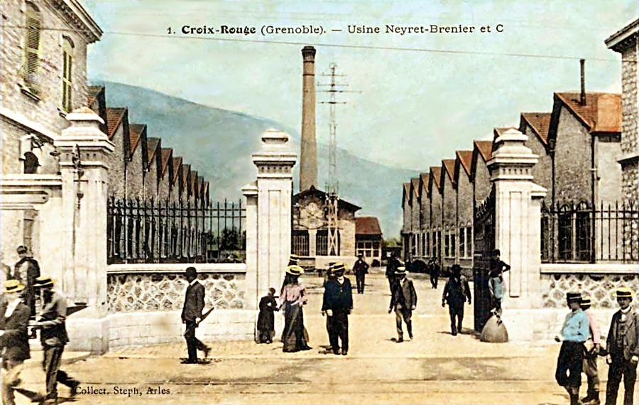
Here we are in a newer area. There are modern
buildings, green spaces and a nice footpath on the site of the former
railway line. It is here that was probably the turning on the side line
for 'Croix Rouge', where Neyret & Brenier's factory once stood as
well as the Brun biscuit factory and the Red Cross distillery.
On Benoit Frachon avenue there is currently the tramway line D, which connects the southern suburbs of Saint Martin d'Heres to the University Campus, via La Plaine.
We'll take a few moments out to visit 'Croix Rouge' and it's old factories.
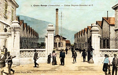
219- Coming out of the Neyret Brenier factory, the railway lines.
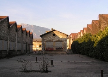
220- The same scene now in 2012, behind the town hall.
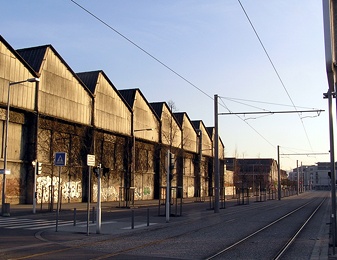
221- Tramway D passing in front of old run down factories.
On Benoit Frachon avenue there is currently the tramway line D, which connects the southern suburbs of Saint Martin d'Heres to the University Campus, via La Plaine.
We'll take a few moments out to visit 'Croix Rouge' and it's old factories.
219- Coming out of the Neyret Brenier factory, the railway lines.

220- The same scene now in 2012, behind the town hall.

221- Tramway D passing in front of old run down factories.

222- Back on the 'Oath of Buchenwald' avenue.
223- The northern forecourt of the 'Jo Blanchon' Park.
224- In front of the Rocheplane medical Centre, wooden houses.
We have crossed a new district of Saint Martin d'Heres.
Olympics Games Avenue has become the avenue of the Oath of Buchenwald
and now it is Liberty Carmagnole Battalion Avenue, names that are
significantly more committed. We have gone past Rocheplane Medical
Centre, inaugurated in 2008 and amalgamating three
institutions, Rocheplane, Meylan Outpatients Centre and the Anguisses.
Now we are coming to an older neighbourhood around Ambroise Croizat
Avenue.

225- The end of the new district and the approach of Ambroise Croizat Avenue.

226- On the other side of Ambroise Croizat Avenue, the railway banking.

227- The railway banking meets a sports field.
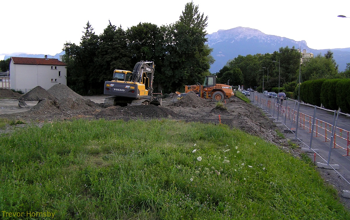
228- Construction of the sports field. 8/7/2008
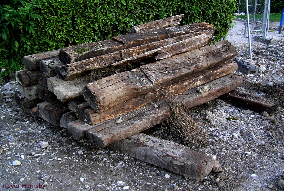
229- On the side, a pile of railway sleepers.

230- The embankment comes to the 'Eparres' flats.
231- Leaving the blocks of flats and heading for the Peri bridge.

232- Just before the bridge some allotments and sheds.

233- Under the Peri bridge, we meet the new Chambery line.

234- Looking ahead towards Gieres station.
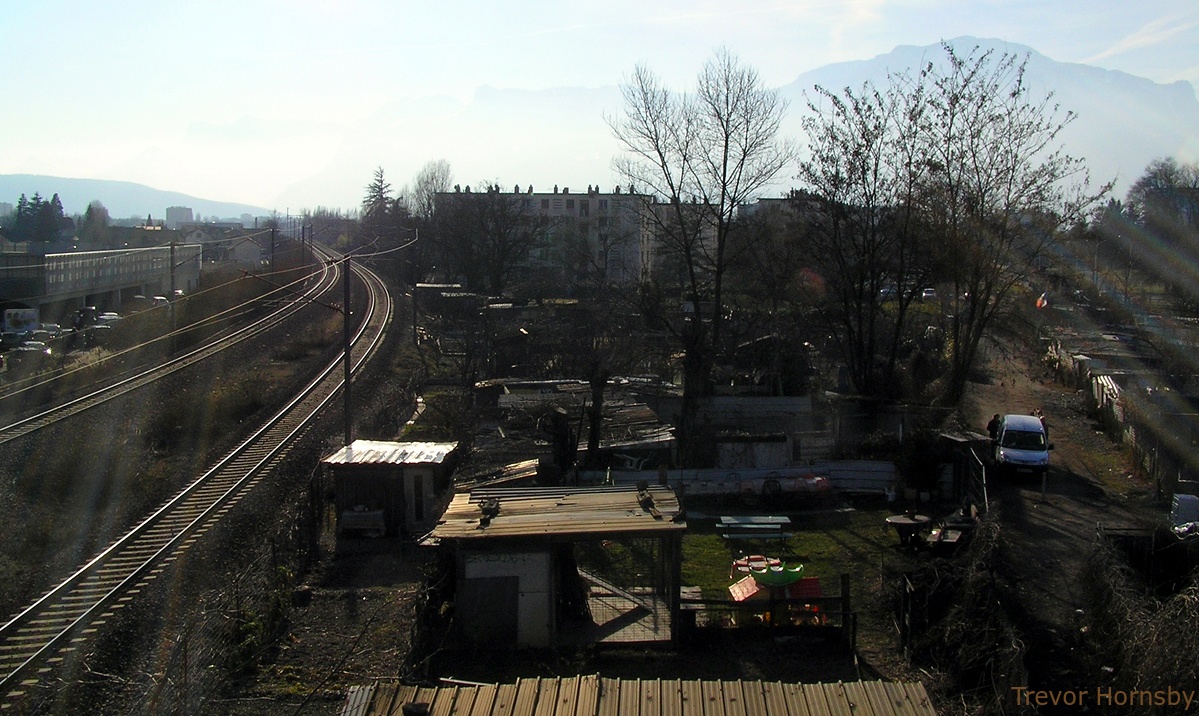
235- View from the bridge to the Eparres, the allotments and tracks.
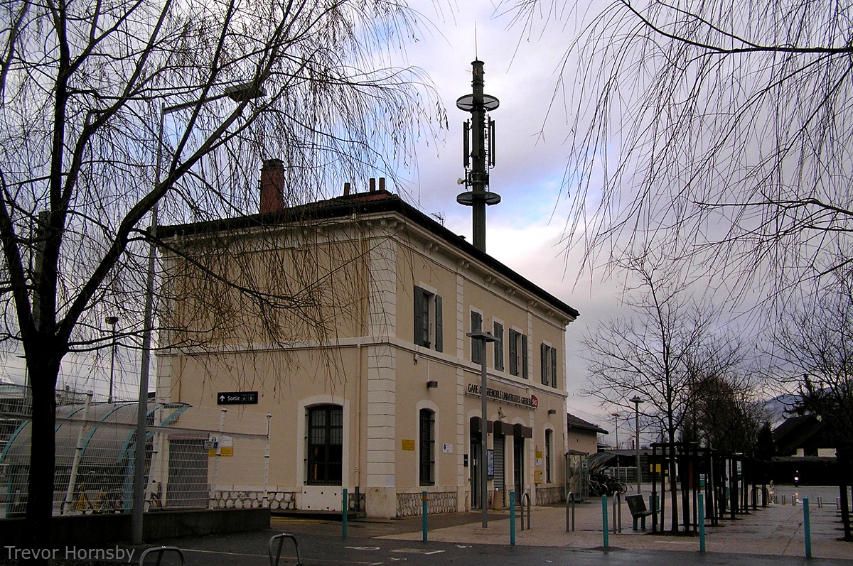
236- The Gieres railway station complete with aerial.

237- The BB 67304, dates from 1967, frequently used for Annecy-Grenoble-Valence.
Our tour of normal gauge railways in Grenoble comes to
an end.
There are still some mysteries for me, and you too perhaps. But by visiting these districts of Grenoble, Echirolles, Saint Martin d'Heres and Gières, we have had a glimpse of the history of our beautiful alpine capital.
It's history with a small 'h', may be, but it's the history of women and men who have contributed to the development and progress of the region, and that is the most important, isn't it?
Stay tuned for more Railway trips!


Autres pages sur ce site qui pourraient vous
intéresser/Other pages on this site which may interest you:

The V.S.B. tramway
Between 1895 and 1936, a tram line linked Voiron to Saint
Béron passing by 'Les Echelles'. On the left we see the animation at
the 'Les Echelles' station in 1911.
You can see all the stations on the VSB line at that time and now
HERE(14 pages).
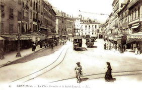
The Isere gorge tramways
Between 1900 and 1938, one could travel by tram from Voreppe to Veurey
passing through Grenoble, and Grenette Square and the PLM railway
station.
You can visit all the stations on the way then and now
HERE(15 pages).
You can see all the stations on the VSB line at that time and now
HERE(14 pages).
You can visit all the stations on the way then and now
HERE(15 pages).
Photo credits:
- 204 et 211, JM Guétat. http://standard216.free.fr/historique_bus.html
- http://www.hannibal-dans-les-alpes.com/
- http://1900anosjours.hpsam.info/photos/grenoble/exposition-internationale-1925.php
- http://insitu.revues.org/217#tocto1n2
- http://www.rocadesud.com/realisations/?actmenu=estacade&ID_rubrique=4
- http://www.artmajeur.com/?go=artworks/display_mini_gallery&image_id=2564745&login=nesse
- http://www.arcachon-nostalgie.com/roger_expert.htm
- http://insitu.revues.org/217#tocto1n2
- http://histoire.trains-en-vadrouille.com/.....
- http://www.euro-photos-trains.com/sncf67300BBC.htm
- http://cccp.trainprovence.free.fr/cccp/article-alpazur2007.html
- http://clode.chez-alice.fr/fretgrenoble.htm
- http://www.lineoz.net/forum/viewtopic.php?f=3&t=3657&start=0
- http://membres.multimania.fr/stephanerevel/histo.htm
- http://www.ville-st-martin-dheres.fr/industrialistation.html
- http://emmatortue.wordpress.com/2009/05/15/ces-biscuits-ont-fait-les-delices-de-mon-enfance/
- La Vie du Rail, N°'s 1104, 1129, 1131 et 1137, Éditions NM Paris, 1967 et 1968.
- Le Bassin du Drac, Auguste Bouchayer. Revue de géographie alpine. Tome 13 N°3. pp. 549-621. 1925.
- Histoire Populaire de Grenoble, Alphonse Vernet. Gratier, 1896.
- Le Chemin de Fer de Grenoble à Villard de Lans. Philippe Guirimand et Patrice Bouillon, 2000.
- Grenoble Autrefois, Jean-Jacques de Corcelles. Horvath, 1996.
- Une Industrie dans la Ville, Bouchayer & Viallet à Grenoble. Hervé Bienfait. Libris, 2004.
- L'Illustration Economique et Financière, numéro spécial, Grenoble et l'Isère, 1923.
- Les Voies Ferrées du Dauphiné, Henri Boyer et Patrice Bouillon, 1983.
- Guide Catalogue Officiel de l'Exposition Internationale de la Houille Blanche et du Tourisme, Saumane 1925.
- Grenoble Autrefois, Claude Muller, Editions des Quatre Seigneurs, 1974.
- Du Tram au Tag, JM Guétat, W Lachenal, G Muller, La Vie du Rail,1987.
