Grenoble around
the Railway.
11- The old Chambery line from the Foch bridge to the Stalingrad garage.
-disused,
forgotten, taken away or
abandoned lines.
11- The old Chambery line from the Foch bridge to the Stalingrad garage.
All
the pictures can be enlarged with a mouse click!
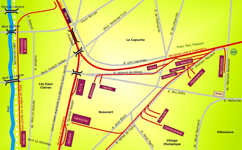
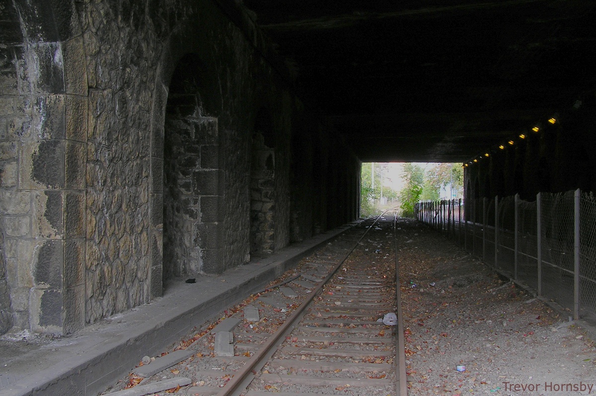
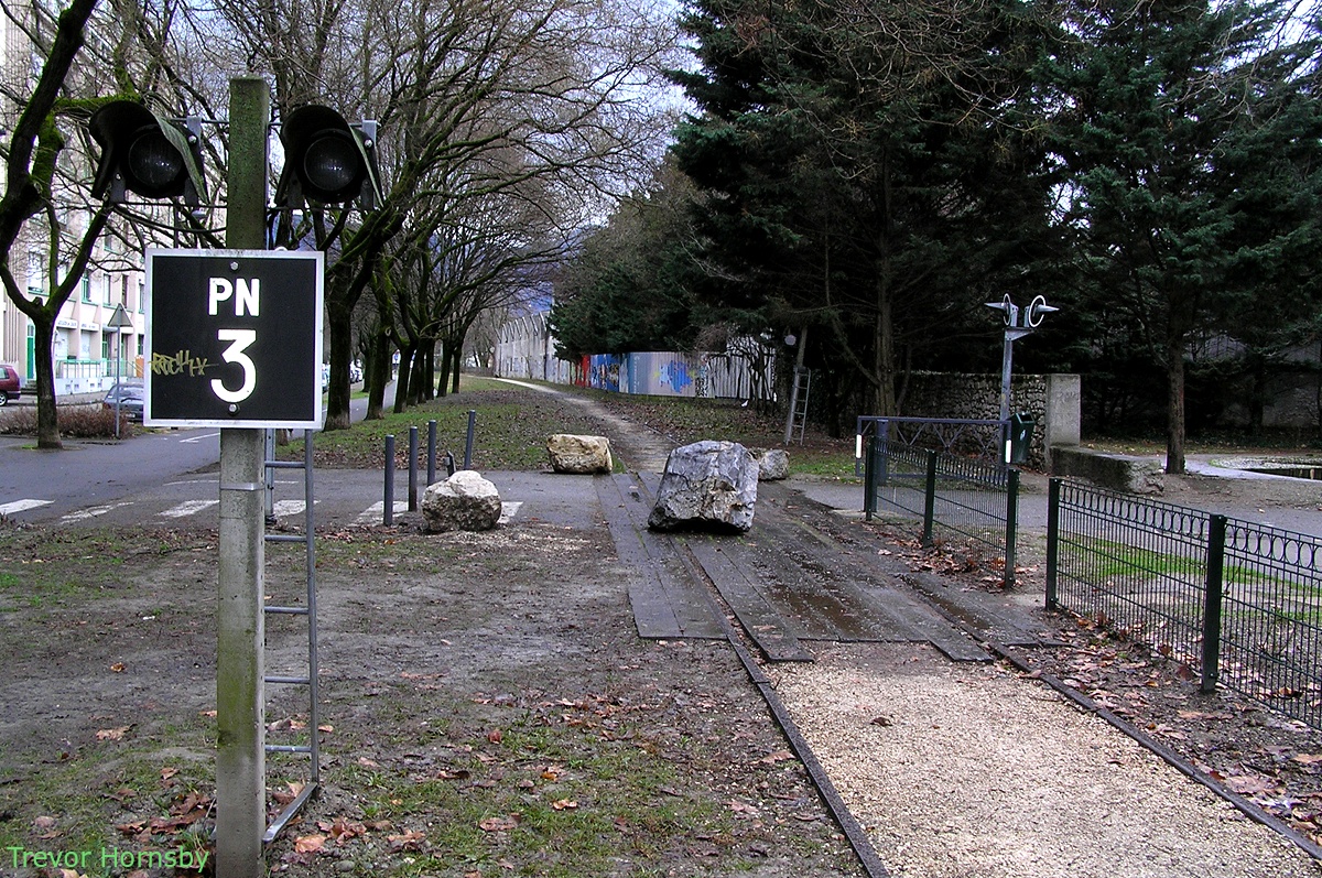
143- The old Chambery line under the Foch bridge.

144- A small part of the line which is missing now.
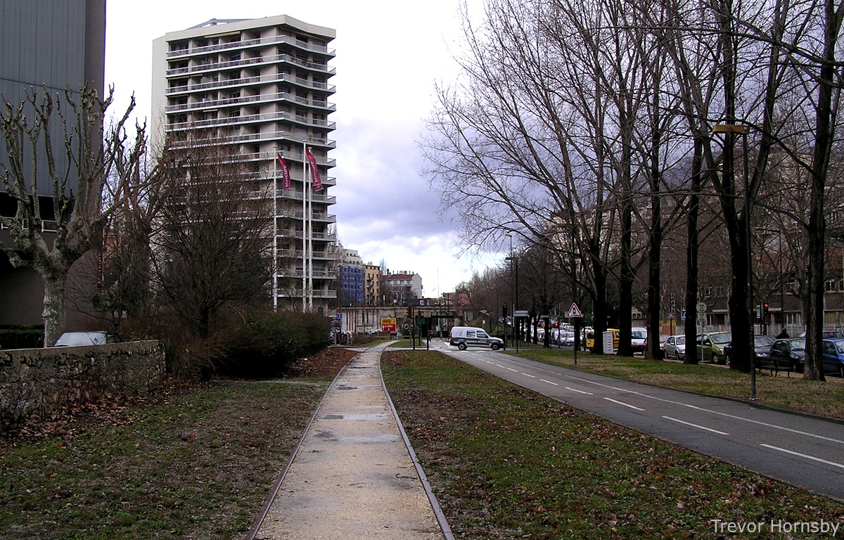
We are back to the boulevards of Grenoble, or rather
under Foch Bridge. Here, one track is left, the other has been replaced
by a cycle track. After the bridge, the rails were torn up as far as
the pedestrian crossing where the General Mangin crossing used to be.
Why? The photo below shows the crossing before 1967. The image, on the
right, shows the same scene now, the keeper's house, of course, has
gone, but the other buildings are all there.
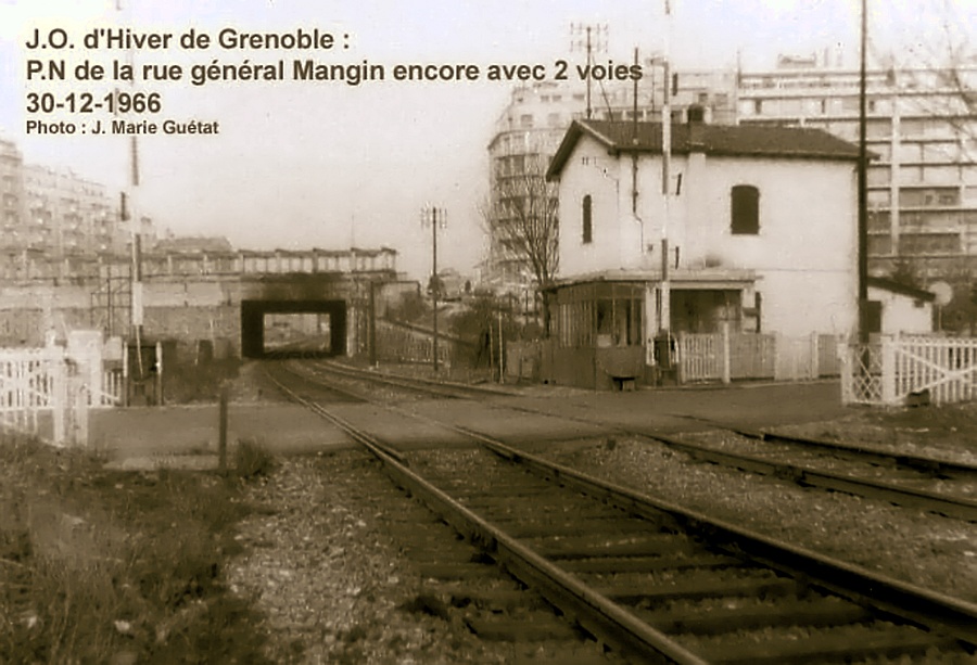
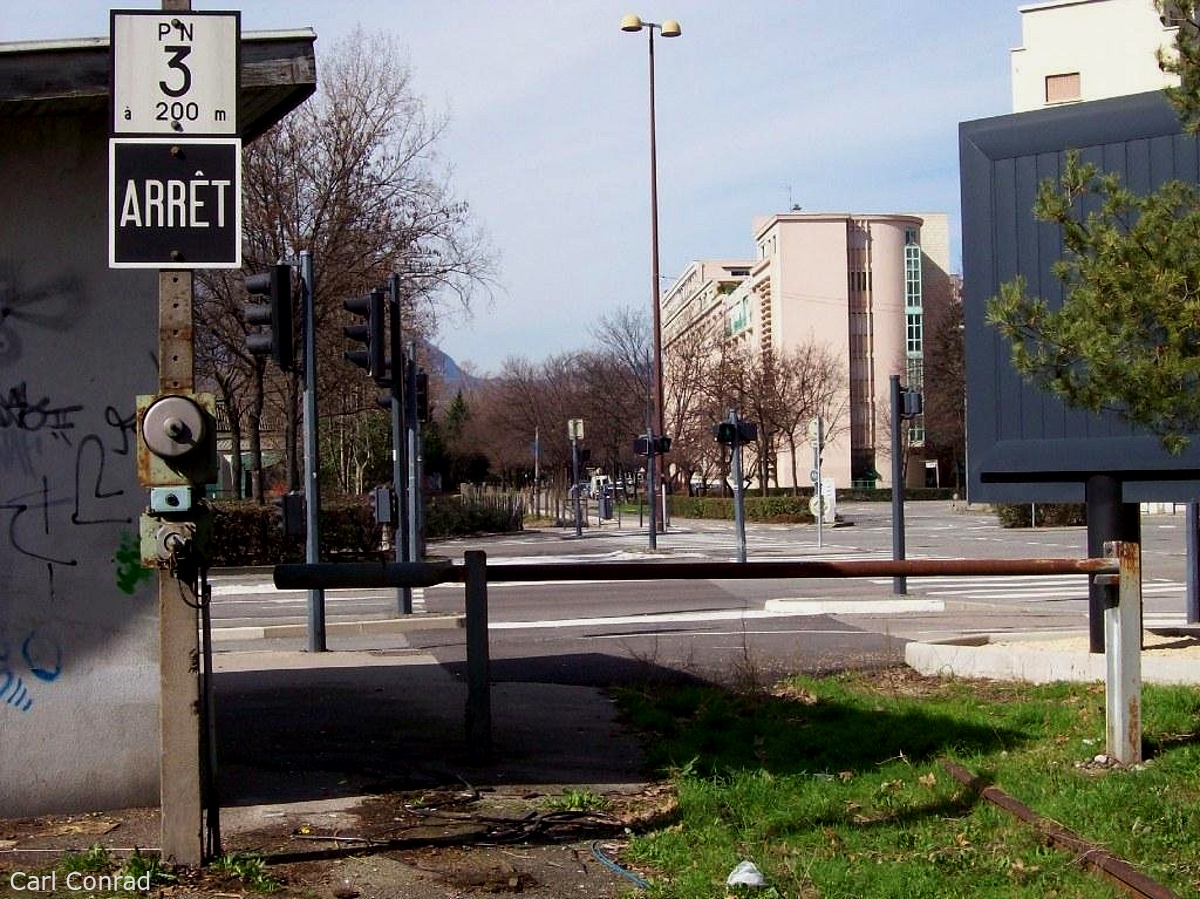
145- The General Mangin road level crossing in 1966.

146- The crossing now, with it's traffic lights.
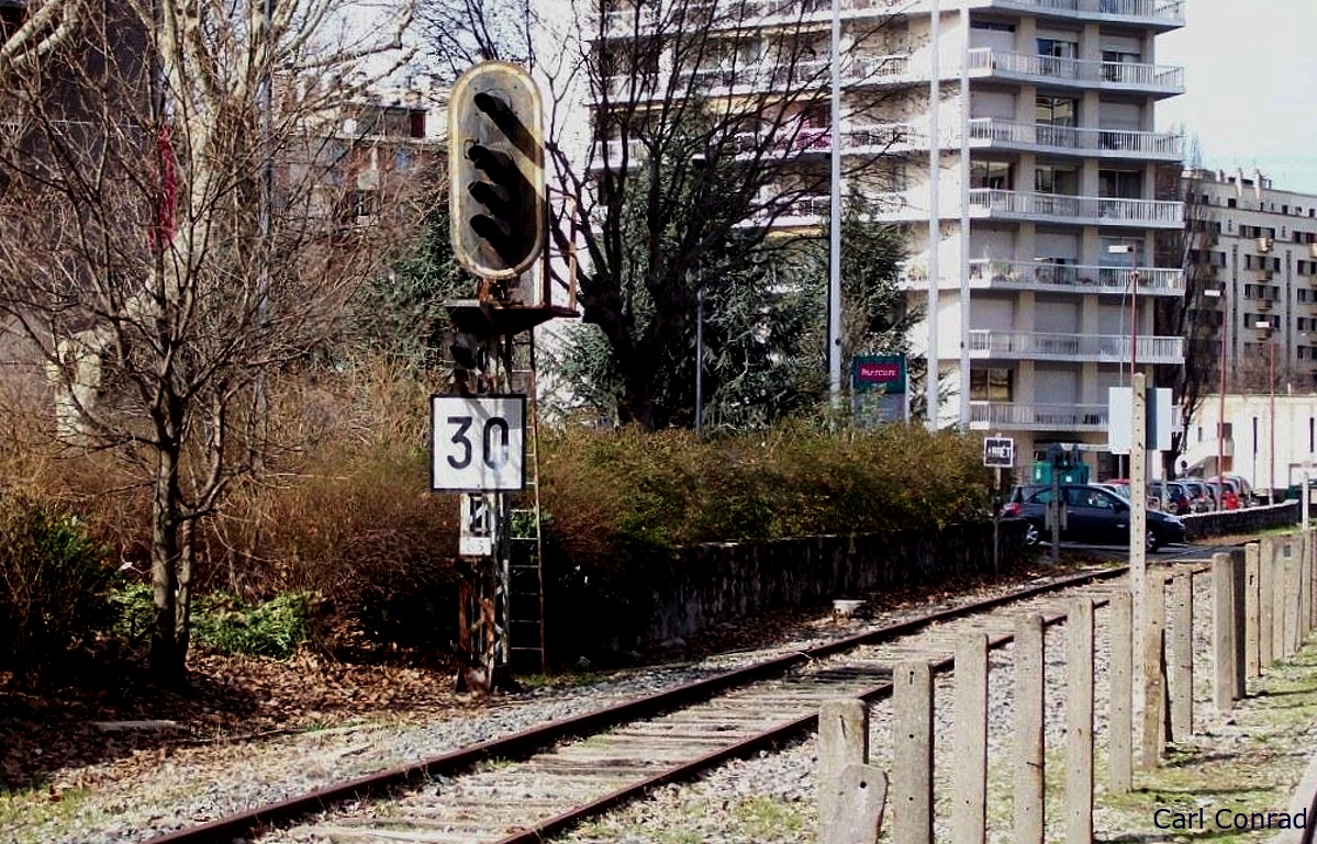
147- The signal before the decommissioning of the line .
After our visit to the Mangin road crossing, and the
remarkable Mangin 16 floor apartment tower, we carry on to Léo
Lagrange street. The line has had several phases to its existence. The
Grenoble-Chambéry service began in 1864. It was an important industrial
development motor, with its many connections to factories and
warehouses on the way. The 1925 exhibition, from this point of view,
was very important. But with the 1968 Olympics, things moved up a gear.
From 1967, the Chambéry line is moved south to Echirolles and Eybens
and one of the two tracks is removed, but the other part continues to
operate until the 2000s. Probably, the last user was Métalisère, which
has now closed. The land is at the heart of the Vigny-Musset
development. The part of the line which served Saint Martin d'Hères is
no longer used after 1975.
148- We go past the Mercury hotel on the left.

149- In front of the Reynies retirement home.

150- Pedestrian access to the Reyniés-Lagrange bowling club.
151- The Reyniés-Bayard sports centre crossing.

152- Here part of the old Bayard barracks wall is visible.

153- A long gone signal.
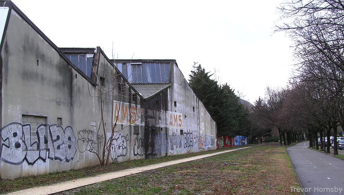
154- Going past the disused AMS electrical construction factory.
155- At the end of the Léo Lagrange road, the 'LOU' building.
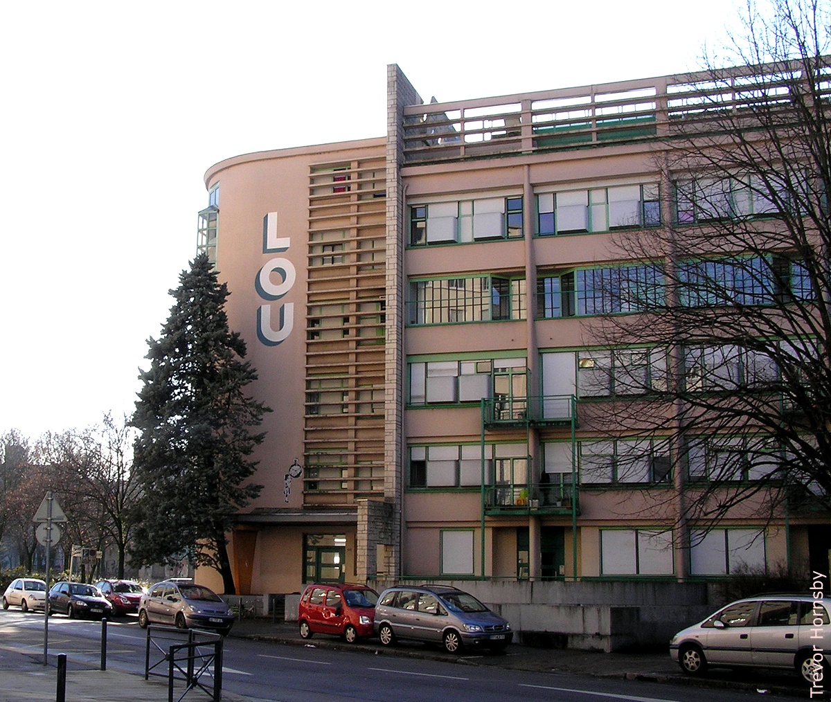
156- The LOU 1983 reconversion.
157- Stalingrad road with the LOU building on the other side.

158- The Stalingrad level crossing in 1967.

159- Going into a wasteland area in 2008.
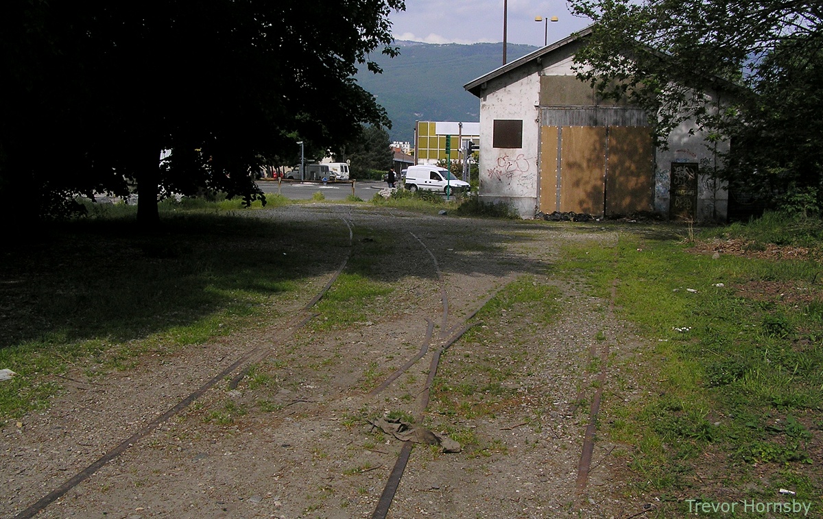
160- A shed and tracks going to Balzac road in 2008.

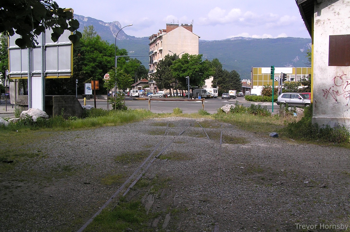
161- In 2012, the shed has gone and the area has been landscaped.

162- Buffers at the end of a parking track.
163- Two sets of tracks, for Balzac and Jacquard roads.

164- Looking from the Balzac road the other side.

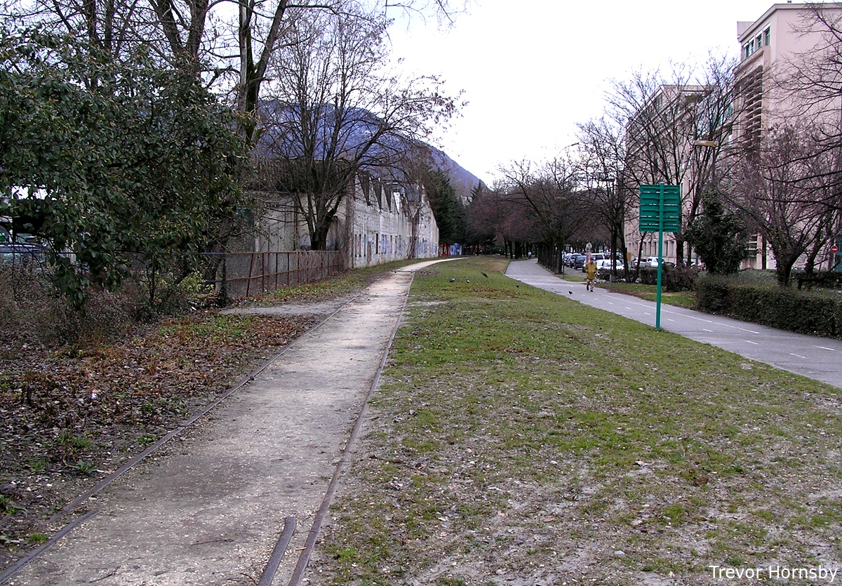
165- Going past the old 'Nord-Est' factory.

166- Looking behind us towards the Stalingrad road.

167- At the end of the road, the line goes through some flats.
We started out at the Foch Bridge went to the sidings
and shed at Stalingrad road, then we left on the
industrial track of Balzac road. In the image on the left, we can see a
curiosity. The railway runs through a block of flats. The railway was
there before the houses, so they had to put up with it. On the other
side, the track crossed the Allies road to the Pacific water heater
factory and a drinks distributor.
The line is no longer in operation and the railway handling and sorting
area is
part of the Faubert Park project and the green corridor.


Photographic credits:
- 145 et 158. JM Guétat. http://standard216.free.fr/historique_bus.html
- 148, 153 et 157, Carl Conrad. http://www.carlconrad.net/fr/
- http://www.hannibal-dans-les-alpes.com/
- http://1900anosjours.hpsam.info/photos/grenoble/exposition-internationale-1925.php
- http://insitu.revues.org/217#tocto1n2
- http://www.rocadesud.com/realisations/?actmenu=estacade&ID_rubrique=4
- http://www.artmajeur.com/?go=artworks/display_mini_gallery&image_id=2564745&login=nesse
- http://www.arcachon-nostalgie.com/roger_expert.htm
- http://insitu.revues.org/217#tocto1n2
- http://histoire.trains-en-vadrouille.com/.......
- http://www.euro-photos-trains.com/sncf67300BBC.htm
- http://cccp.trainprovence.free.fr/cccp/article-alpazur2007.html
- http://clode.chez-alice.fr/fretgrenoble.htm
- http://www.lineoz.net/forum/viewtopic.php?f=3&t=3657&start=0
- http://membres.multimania.fr/stephanerevel/histo.htm
- La Vie du Rail, N°'s 1104, 1129, 1131 et 1137, Éditions NM Paris, 1967 et 1968.
- Le Bassin du Drac, Auguste Bouchayer. Revue de géographie alpine. Tome 13 N°3. pp. 549-621. 1925.
- Histoire Populaire de Grenoble, Alphonse Vernet. Gratier, 1896.
- Le Chemin de Fer de Grenoble à Villard de Lans. Philippe Guirimand et Patrice Bouillon, 2000.
- Grenoble Autrefois, Jean-Jacques de Corcelles. Horvath, 1996.
- Une Industrie dans la Ville, Bouchayer & Viallet à Grenoble. Hervé Bienfait. Libris, 2004.
- L'Illustration Economique et Financière, numéro spécial, Grenoble et l'Isère, 1923.
- Les Voies Ferrées du Dauphiné, Henri Boyer et Patrice Bouillon, 1983.
- Guide Catalogue Officiel de l'Exposition Internationale de la Houille Blanche et du Tourisme, Saumane 1925.
- Grenoble Autrefois, Claude Muller, Editions des Quatre Seigneurs, 1974.
- Du Tram au Tag, JM Guétat, W Lachenal, G Muller, La Vie du Rail,1987.
